JANUARY - MARCH 2014
THE SLABS, ARIZONA, NEW MEXICO and TEXAS
Travelogue#1 Travelogue#2 Travelogue#3 Travelogue#4 Travelogue#5 Travelogue#6 Travelogue#7 Travelogue#8 Travelogue#9 Travelogue#10
TRAVELOGUE #8
February 28 - March 4, 2014 - from Albuquerque thru Gallup and on to Flagstaff AZ on the way to the Grand Canyon.
We left Albuquerque (actually Bosque Farms about 20 miles south) heading west thru New Mexico toward Gallup, crossed the Continental Divide, and stopped at Red Rock Park just before Gallup. When we arrived at the park we took a walk up a beside a creek bed toward Church Rock, one of the main rock formations. It was warm and sunny and beautiful lighting from the late afternoon sun. There was only one other RV in the park. It rained all night and got very windy. Next day, I checked the forecast and it called for 30 - 60 mph winds and snow! We ended up staying at Red Rock Park a second night. We were the only ones in the campground.
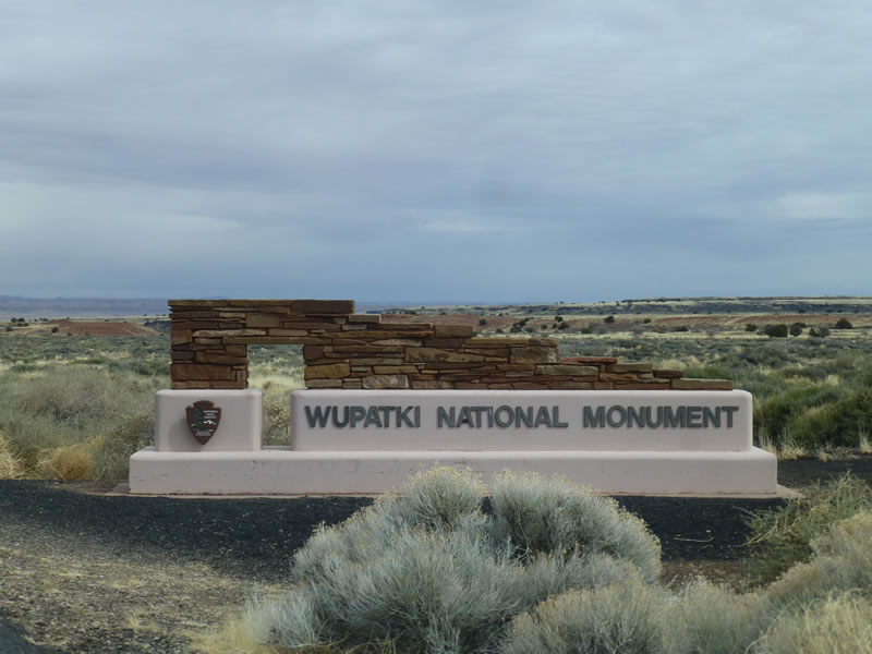
After driving through the Navajo Reservation for a bit, our next stop was the Petrified Forest National Park and the Painted Dessert - a combined park. Beautiful and fascinating colors and rock formations. The two halves of the park were completely different - the Painted Desert in the north, the petrified forest in the south. We continued west and camped at Homolovi State Park outside Winslow AZ. The next day we explored the ruins of various pueblo groups who lived along the Little Colorado River. After spending most of the day exploring, and stopping for groceries and gas, we only made about 50 miles to Flagstaff. The following day we visited Walnut Canyon with some amazing cliff dwelling ruins, then headed north passing Sunset Crater Volcano National Monument and Wupatki National Monument - more pueblo ruins.
We were not far from the Grand Canyon at this point. That will be in the next Travelogue!
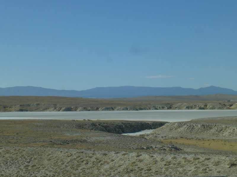
There was a huge series of dry lakebeds. Native Americans mined them for salt supplies.
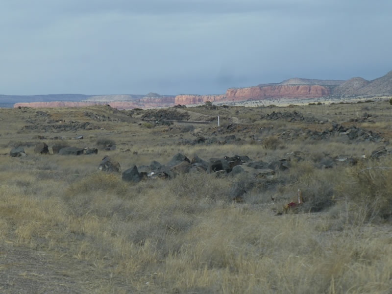
As we drove along in NM, I saw this line of red bluffs stretch into the distance as far as you could see.
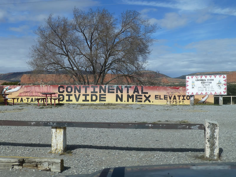
Crossed the Continental Divide.
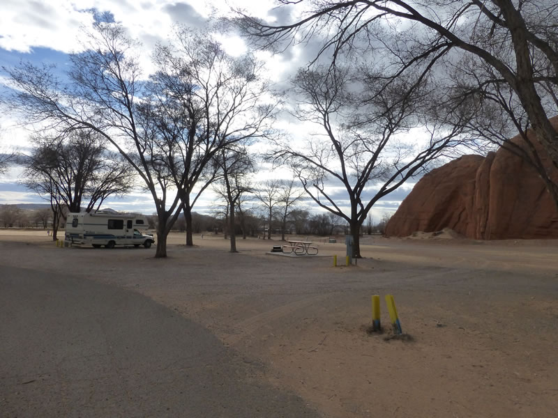
Here we are at Red Rock Park just outside Gallup. We were the only ones until another RV pulled in to stay the night.
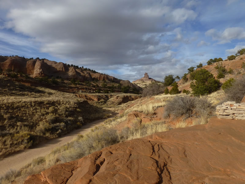
Beautiful afternoon sun lights up Church Rock (above and below).
Why do they call this Red Rock Park???
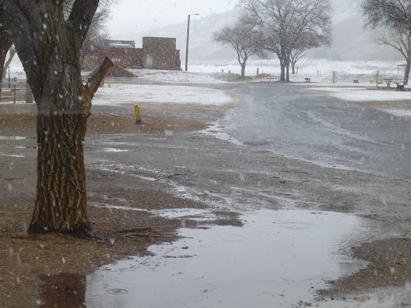
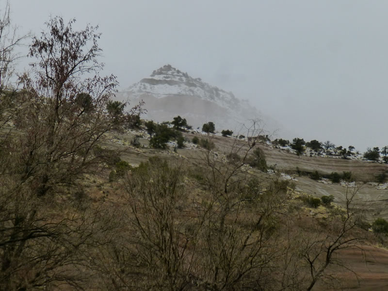
Next morning - complete weather change!
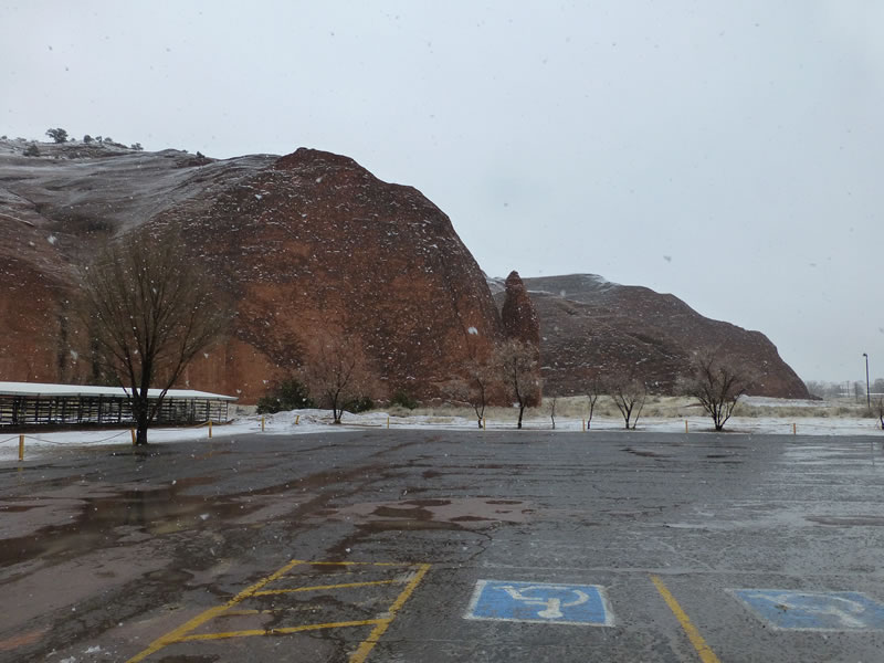
Red Rocks in the snow.
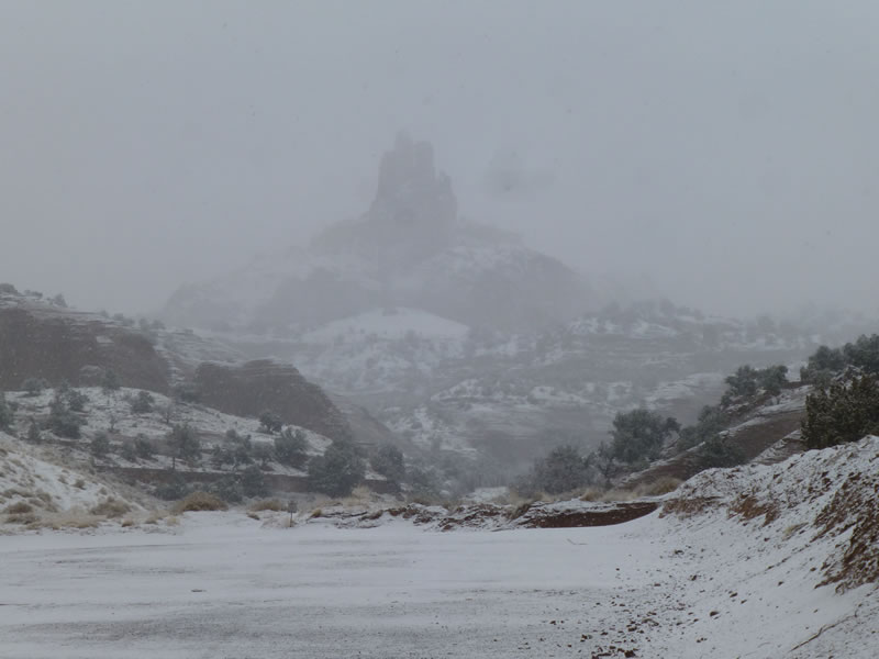
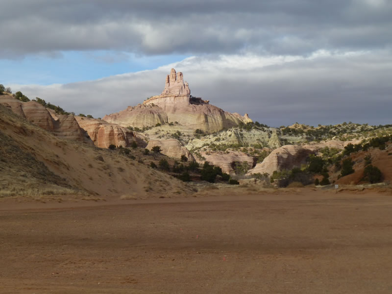
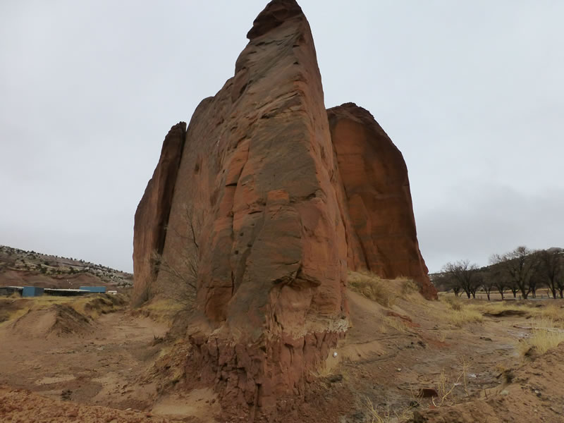
Here's Church Rock.
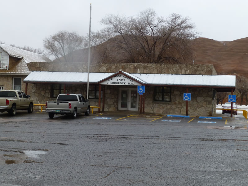
This is the only time I ever saw a Post Office in a State Park. This was the source of the only traffic during our "snow day".
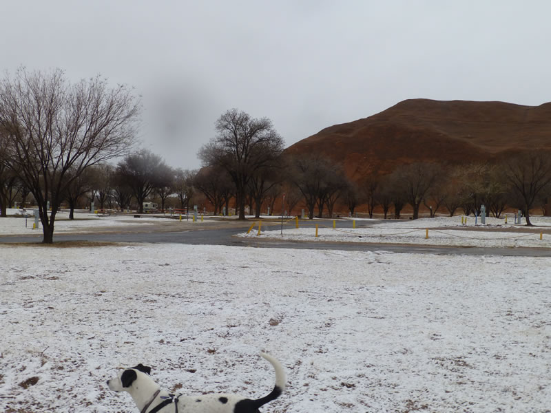
Can you see my RV way off on the left? We were the only ones in the park.
This huge skinny rock made a wall between the two parts of the park.
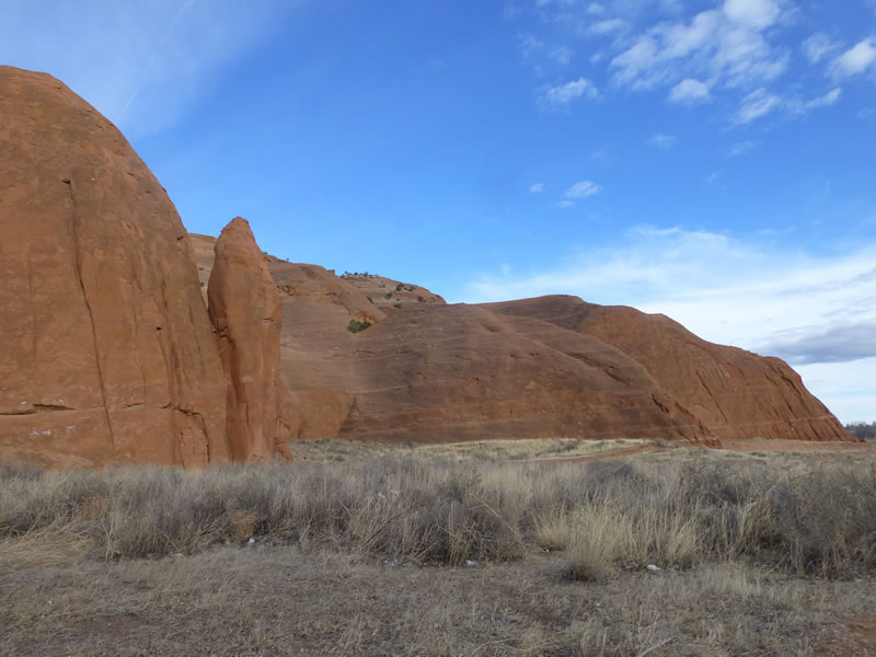
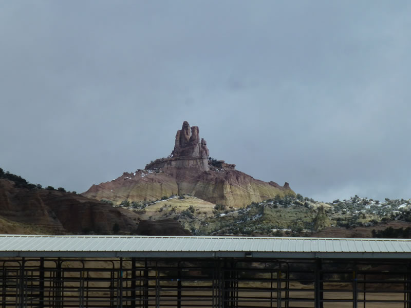
This is Pyramid Rock, the other main rock formation.
We walked over to where they had a huge convention center and rodeo grounds. They were setup for large horse events.
Here's Church Rock on the 3rd morning. Sun is almost out and winds had died down. The colors and textures of the formation was fascinating.
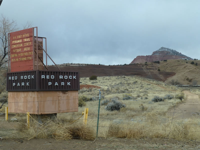
Entrance wtih Pyramid Rock on right.
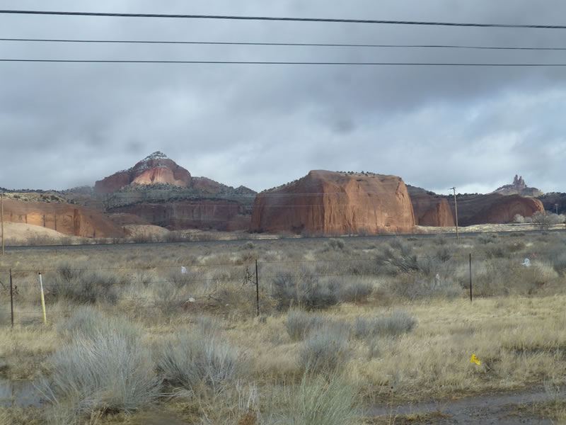
Looking back from the highway, you can see both main rock formations.
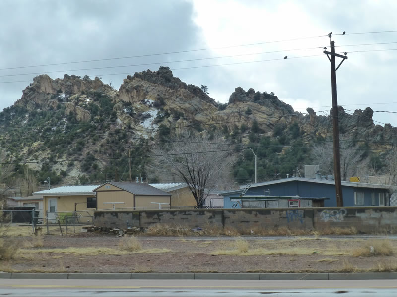
This was in Gallup - just amazing folded rocks behind the houses.
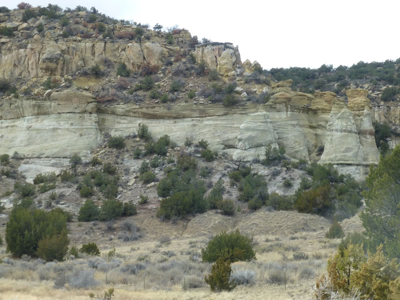
More rock formations - love the yellow colors.
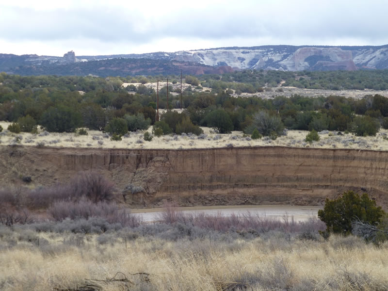
The Puerco River had cut straight down thru the layers of rock.
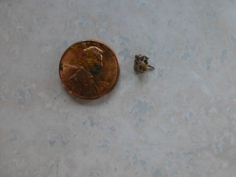
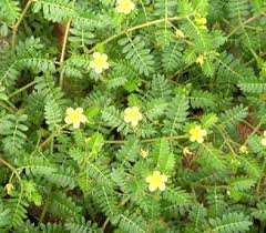
This is the MOST annoying thorn I have ever run into. (above and below). Called "goathead" you can see in the photo below how it got this name. It always has at least 3 points and is engineered so that one is always pointing up. They were everywhere in the southwest. Sunna would get them in her foot pads. She would start to limp and she learned to stand still until I could brush it away. I noticed they also stuck to the bottom of my shoes and at first I didn't realize I was tracking them inside! Sometimes I had several dozen stuck to my shoes when I checked before going inside. The photos below are from the internet - the plant even has cute little flowers.
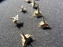
Such nasty little suckers!
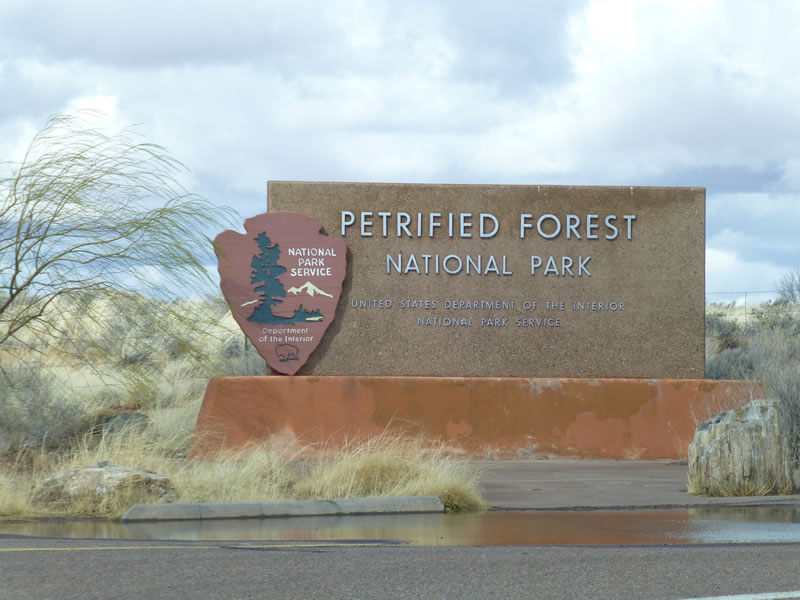
This was a joint park: Petrified Forest and Painted Desert.
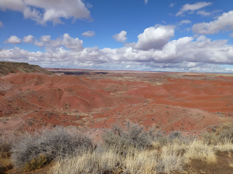
We drove thru the Painted Desert first. We hiked a trail along a rim looking down on the rock formations in the valley below.
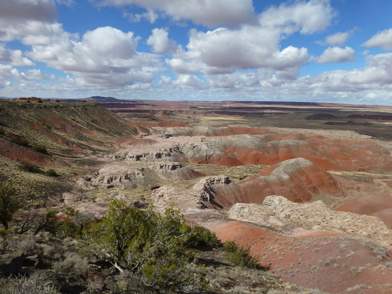
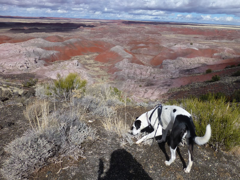
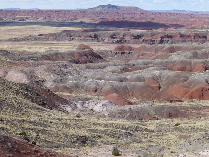
It was huge - extended as far as you could see.
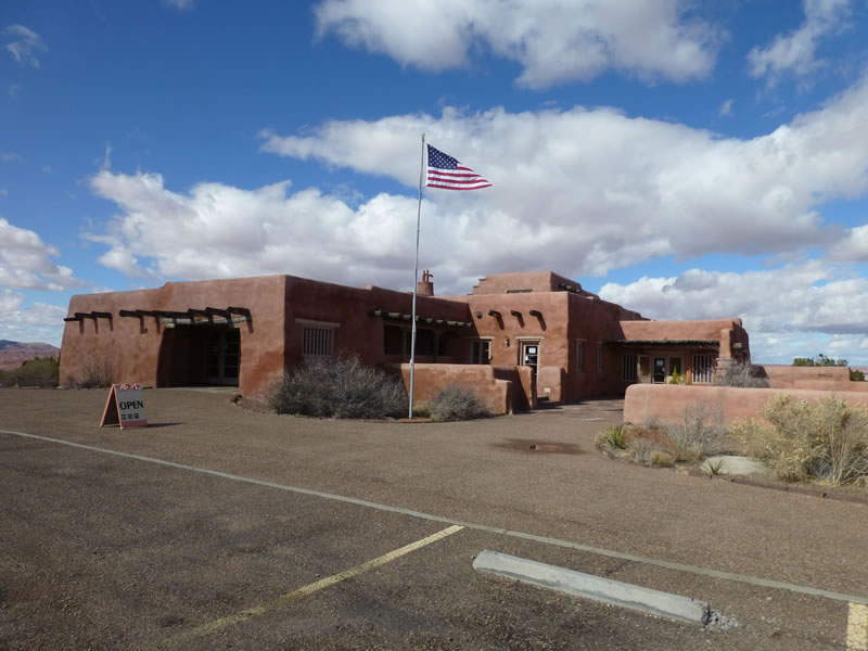
The Painted Desert Inn, built in 1924. When it opened, they had to haul water from a great distance and there was no electricity. So they built a generating plant. It is now a museum and bookstore. It sits on the rim with a panoramic view of the Painted Desert.
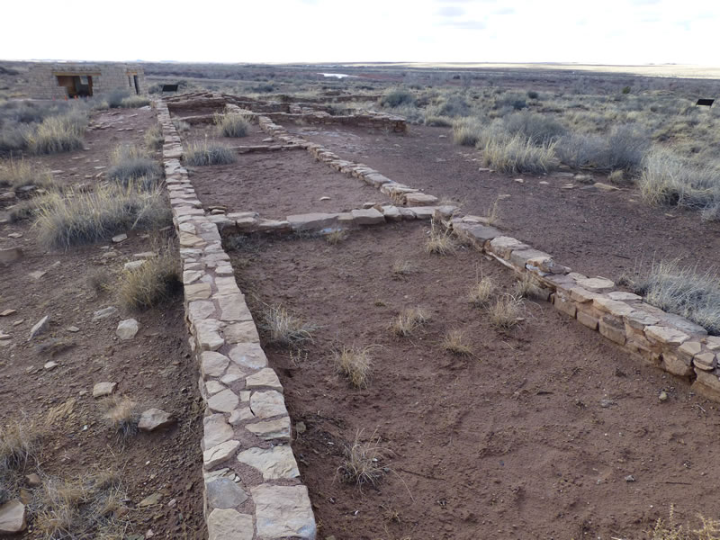
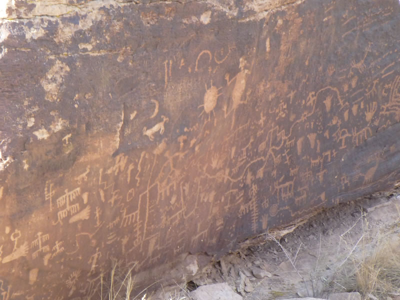
As we left the Painted Desert and headed south in the park, we drove thru an area with lots of ruins and petroglyphs. This is the Puerco Pueblo, next to the Puerco River.
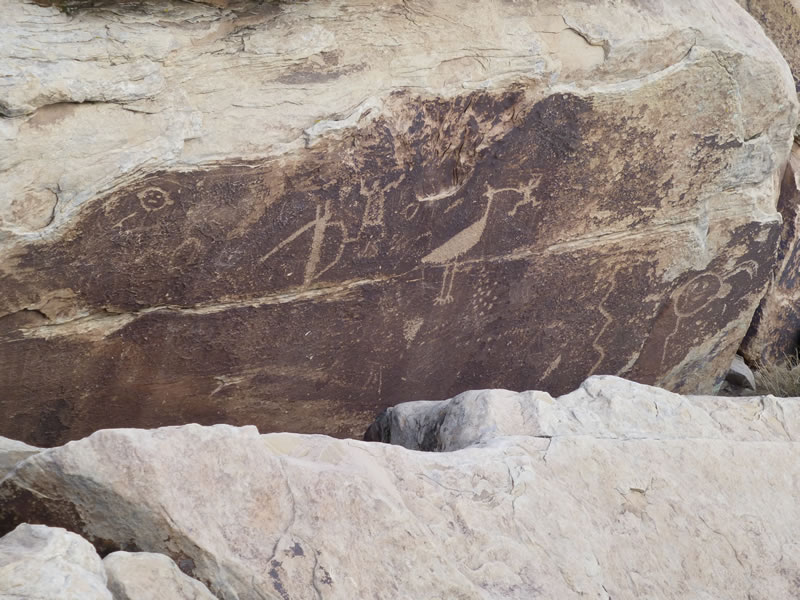
Petriglyphs (above and below) dubbed Newspaper Rock.
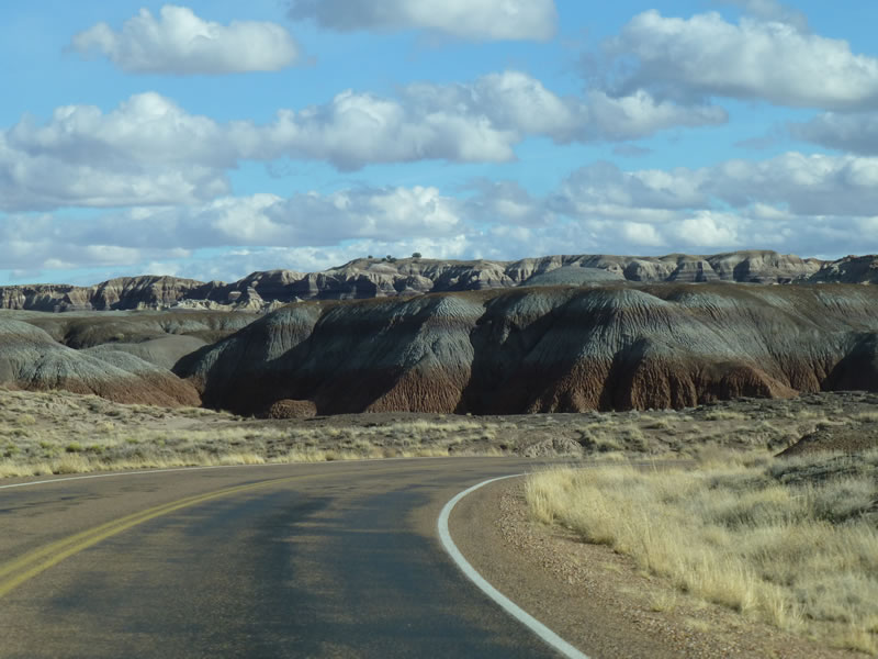
Amazing colored layers of rock.
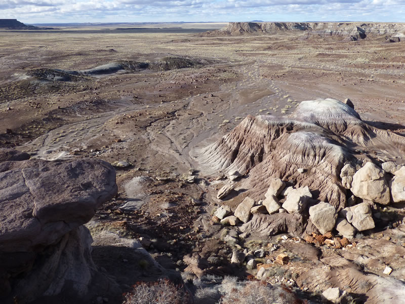
This is taken from a ridge looking down at where lots of petrified wood fragments are found (they were collected for years with abandon, so this is just what's left). The brown rounds look just like any tree round...
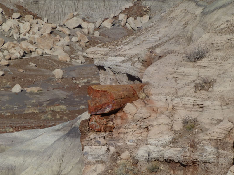
Here's a petrified tree sticking out of the rock wall, hundreds of feet above the valley.
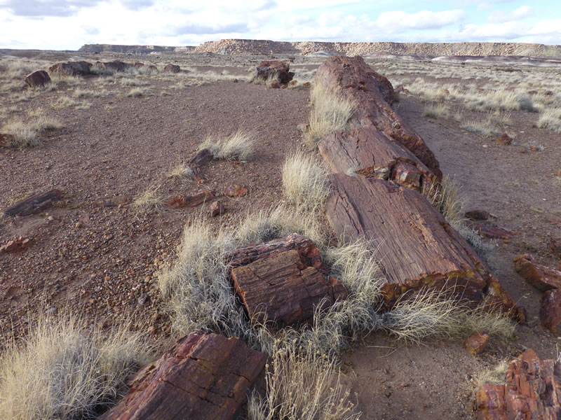
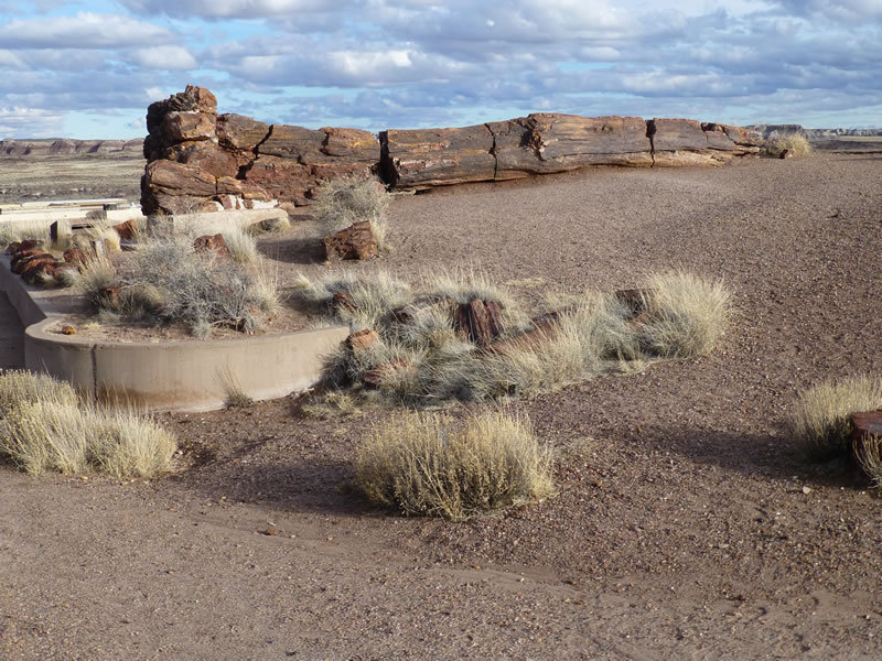
This is one of the largest full tree stumps found.
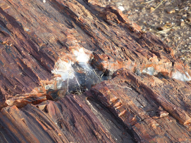
Up close you can see the calcified rock.
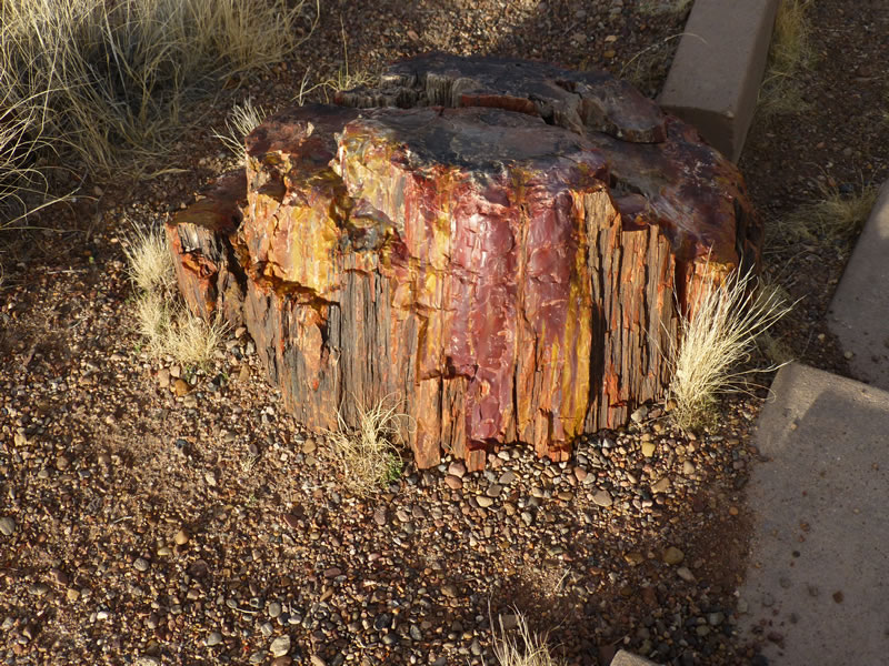
Lots of great colors!

Jack Rabbits in the campground at Homolovi. See the ears on the right?
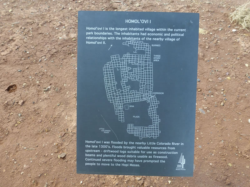
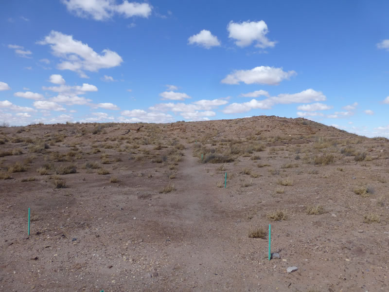
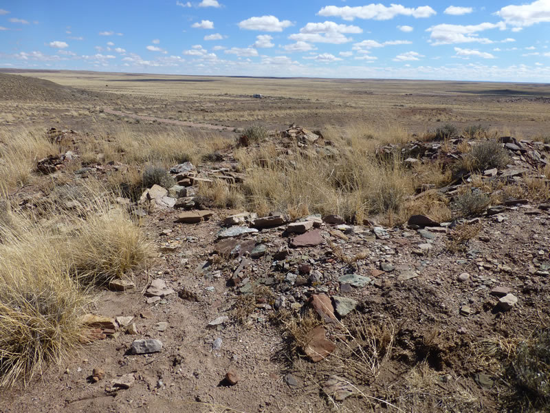
This is most of the ruin - just a mound. How did they figure out this was an archeological site?
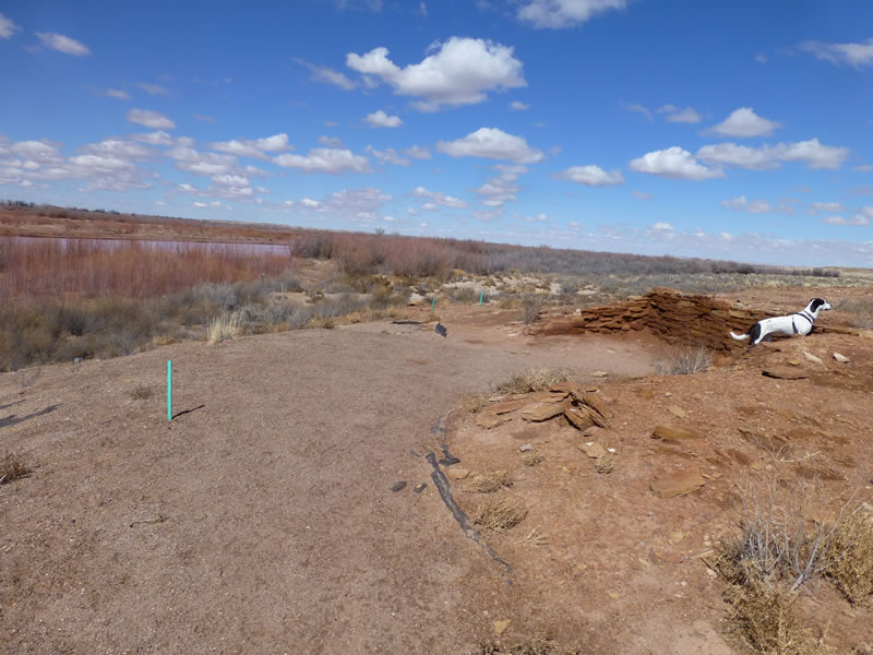
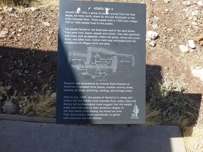
They have only excavated a little bit of it. The Little Colorado River is in the background.
This site was at the top of a hill with an expansive 360 degree view.
A much bigger settlement: 750 - 1000 people probably lived there.
This is the view from the ruins. Notice the RV waaaaaaaaaaaaaaay off out there. And nothing else in sight.
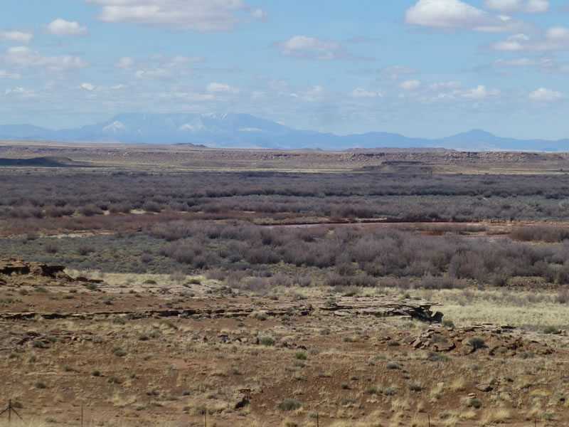
There's the Little Colorado again. Without water, this settlement would never have been here.
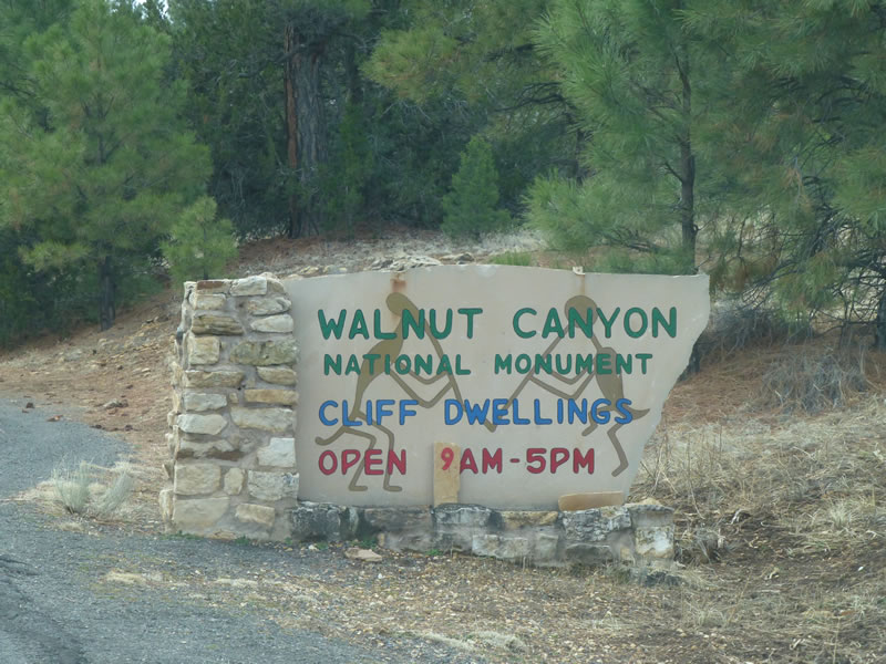
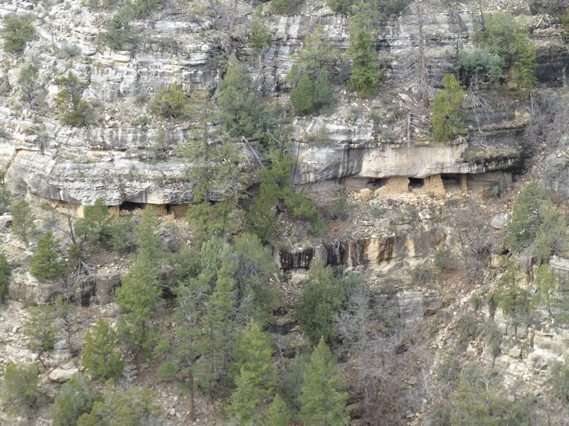
Walnut Canyon is just south of Flagstaff AZ.

It's hard to capture it in photos, but the river flowed almost completely around this rock making a virtual island. That's where they built their cliff dwellings.
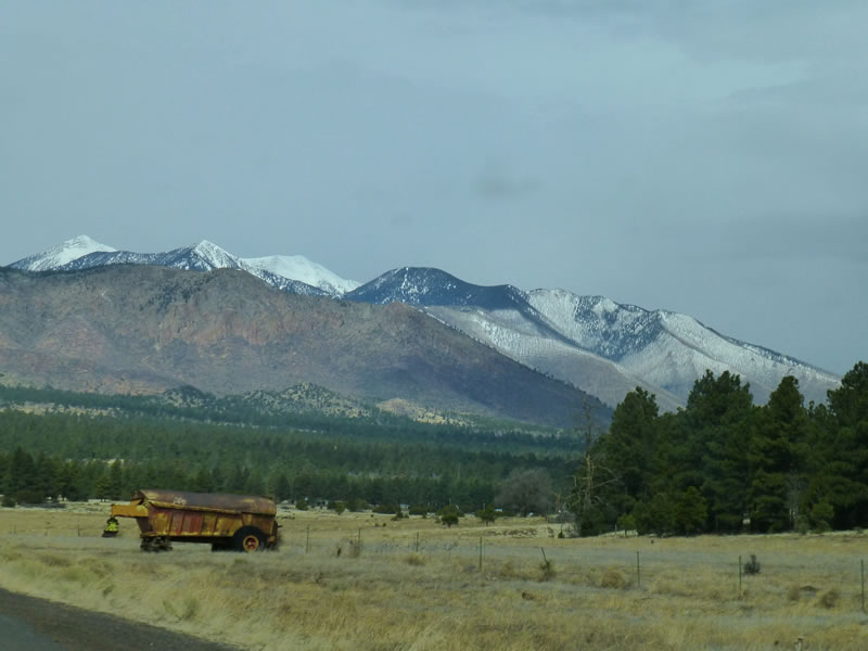
These are the San Francisco Mountains - a major feature of the landscape around Flagstaff and visible from miles away in many different directions. They just rise out of the flat plain.
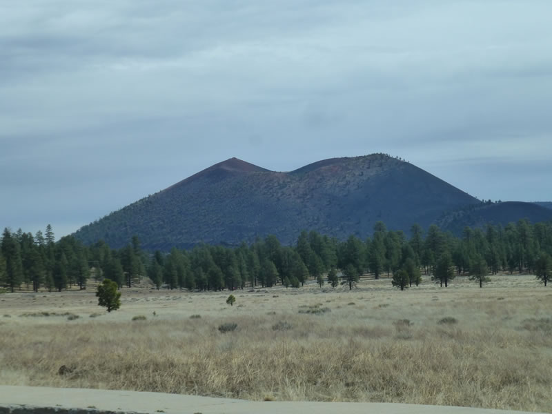
This is the Sunset Crater Volcano.
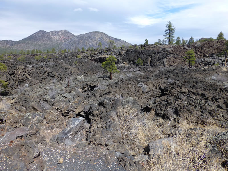
This was surprisingly rough aa (ah-ah) lava field on the side of Sunset Crater.
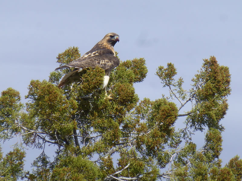
This red tailed hawk flew right in front of me and then stopped in the tree so I could take his/her picture.
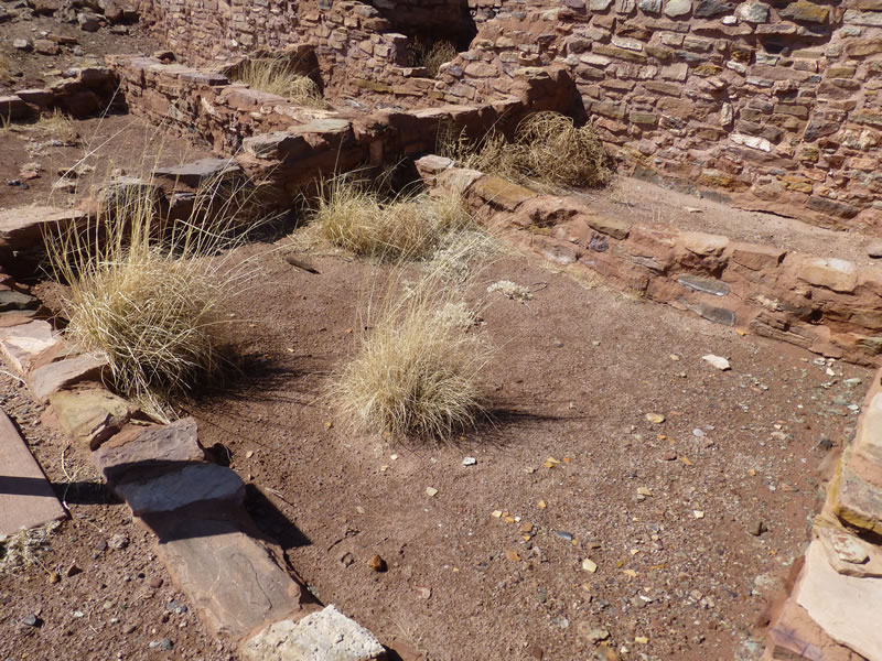
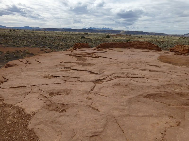
Another collection of ruins. Again these settlements were built near the Little Colorado River.

Perched on a rock outcropping and built along the contour of the rocks.
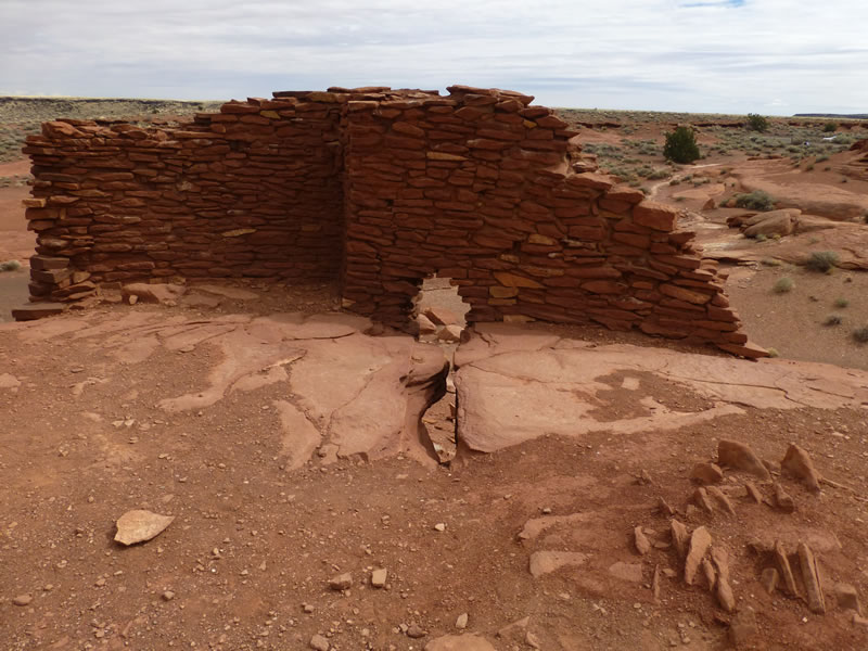
This keyhole was like a window, taking advantage of the natural rock formation.
This was like a porch or deck. A big open flat space without walls.
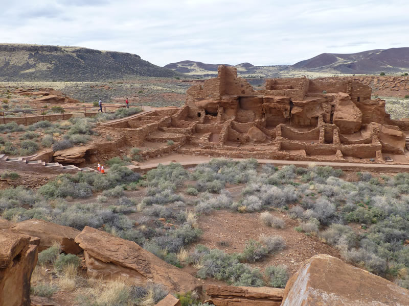
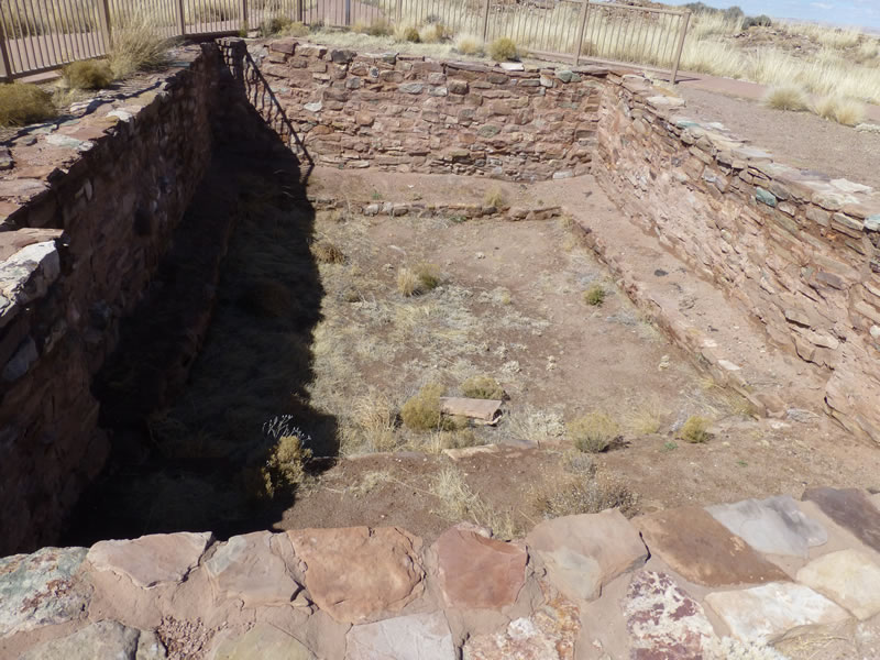
This is another settlement, much bigger than the first one.
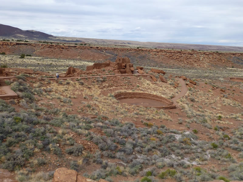
There are at least 3 kivas in this one (the round holes - probably used for ceremonials).
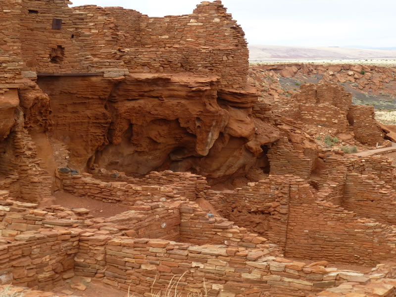
Again, look how they built their structure around the base rock.
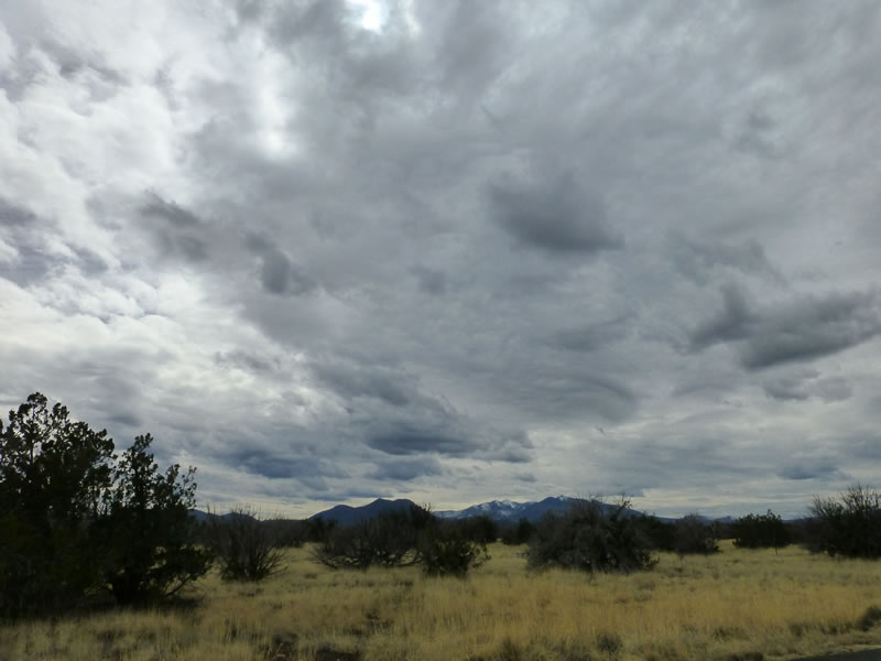
One more view of the San Francisco mountains as I head north toward the Grand Canyon. This small photo doesn't do justice to the magnificense of the cloud formations.
If you wish to receive my travel updates in email, contact me at apalmer123@msn.com