June 10th – 11th
We drove from Cheney to Connell. The day’s temps were in the high 90’s so we didn’t do much in the afternoon. On the 11th we left early and drove down to Monumental Dam on the Snake River, on Devil’s Canyon Rd. We were following the original path of the Palouse River. There were so many basalt rock features, that we weren’t sure which one was “the monument”, but we found it. From the Monumental Dam we drove north, stopped at the Lyons Ferry State Park on the Palouse River, originally named the Drewyer’s River, named after one of the early explorers with the Lewis and Clark expedition. Then we continued past Washtucna to see the Staircase Rapids (they were hard to find because there’s no water there now!).
HISTORY: Story of how the Palouse River was changed by Ice Age Floods
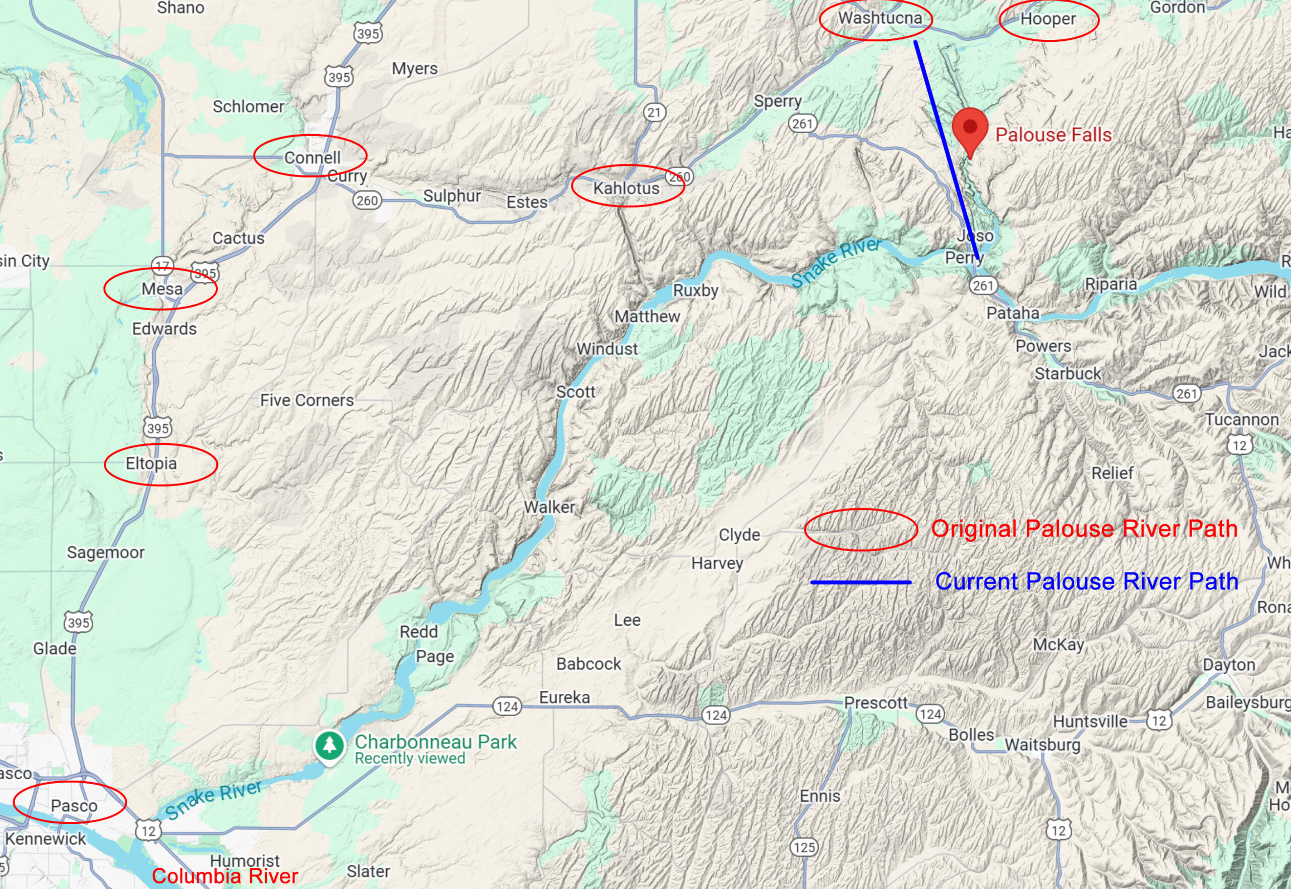
Long before the Ice Age Floods rampaged south through the scabland tracts, the Palouse River followed a southwesterly path connecting to the Columbia River (see the first map below). But the Floods overwhelmed the old river path, gouging a new southward path along a major fracture zone and forever capturing the Palouse River in an almost arrow straight path along the fracture and took a much shorter route to connect with the Snake River. Over the course of many Floods spilling over the basalt cliffs lining the Snake River further south, the Floods tore away at the basalt bedrock of the fracture zone, causing the basalt cliff face to retreat along the fracture zone as a “recessional cataract”. The spectacular Palouse Falls now marks the farthest northern recession of the major cataract, but the erosional coulee extends farther northward to the original path of the Palouse River.

This map shows the original and current path of the Palouse River (follow towns in red ovals). Click HERE to enlarge map.
You can see the straight line above the Falls which is the fracture zone that the Floods followed and redirected the river’s path to the Snake River. Click HERE to enlarge map.
Before the Ice Age Floods, the Palouse River would have flowed over 52 miles through present day Washtucna, Kahlotus, Connell, Mesa, and Eltopia before entering the Columbia River near the Pasco Airport. Today, it takes a forty-mile shortcut to go only 12 miles to merge with the Snake River at Lyons Ferry via the Palouse Canyon and Palouse Falls.
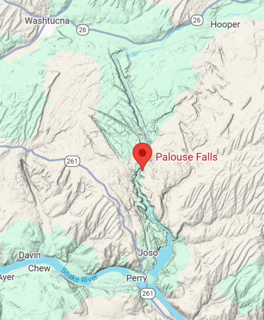
When we first visited Palouse Falls (see 2025 IAF #1 Travelogue), we chose to go west on 124 and 12, then north on 395, east on 260 and 261 until we turned on Palouse Falls Rd. We didn’t realize until later that we just drove the original path of the Palouse River! After the Falls, we drove up to Washtucna so we could follow the final part of the original path of the Palouse River and view the Washtucna Coulee and the vertical rock walls created by the Ice Age Floods.
It was only after we visited Palouse Falls in my first travelogue that I heard this story and I dug deeper so I could share it with you. Later we also went to the Washtucna Coulee so we could see the effects of the Ice Age Floods as it scoured the path of the original river.
Here’s an interesting article with many more details: Washington Landscape Blog – Palouse River
My photos:


