February 12th
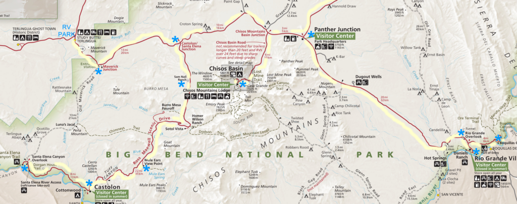
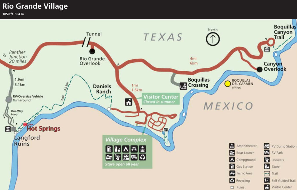
This was my second day in Big Bend NP, in Texas. I drove across the park, at least 50 miles to Rio Grande Village, needless to say it’s on the Rio Grande River! The drive was fascinating, lots of different rock formations, dry river beds, info about the history and geology of the region.
In the Village there was a visitor’s center, and a lodge, restaurant, a campground, a nature trail, and more. Lots to do. I had stayed in this campground in 2014 and did not have the luxury of exploring the entire park (I was only there for one night).
After exploring the village, I drove out to the end of the road on the river, amazing views of the rock formations, and even a group of wild burros. As I headed east toward Boquillas Canyon and the view of Sierra del Carmen range (in Mexico), there were many unique mountains with a lot of limestone deposits. These rock formations cover the entire footprint of Big Bend NP all the way over to Santa Elena Canyon on the SW side of the park. In fact, the rock formations dropped several thousands of feet from Rio Grande Village to Santa Elena Canyon. See the display sign below, “Sunken Rock”, for details. For 47 million years this was the Western Interior Sea and many small sea creatures’ remains were covered in the sediments which eventually became solid rock, and eventually rising above the sea level. Most of it is limestone.
On my way back to the RV park, I also stopped at Dugout Wells outside of Panther Junction. Fascinating natural spring that has been preserved for over 100 years in spite of the severe desert.
Open in new tab to enlarge.
Open in new tab to enlarge.
My first visit to Big Bend was in 2014, a shorter visit. Check it out HERE. Start at the 10th photo, Noah’s Ark in miniature.
Hover over any photo (below) to see the caption. Click on any photo below and you can scroll back and forth thru them. Use the arrows at the bottom of each photo.


