May 26th (Memorial Day) – May 30th
Since there were RV spaces available again at the end of the holiday weekend, we headed to Clearwater Crossing RV Park in Orofino Idaho on the Clearwater River. It was very hot, so we kicked back and relaxed all afternoon. The next day Loris helped Myrna try to repair her driver’s seat where several bolts broke and the seat was loose. I took some time to walk all around the town and a nice city park on the river.
On Wednesday, we headed toward Missoula Montana, a long drive. We were able to get sites at Jim & Mary’s RV Park north of Missoula and close to I-90 and SR93. The next day we drove into Missoula to the Montana Natural History Center, in downtown and near the Clark Fork River, and we met up with Jim (…) a long time member and one of the founders of the Ice Age Floods Institute, a non-profit organization to help promote the story of the Ice Age Floods. He and his wife spent several hours telling us about the IAF, what he has done, and what we ought to go see. We were very grateful that they gave us their time. He has been digging into the IAF for over 40 years!
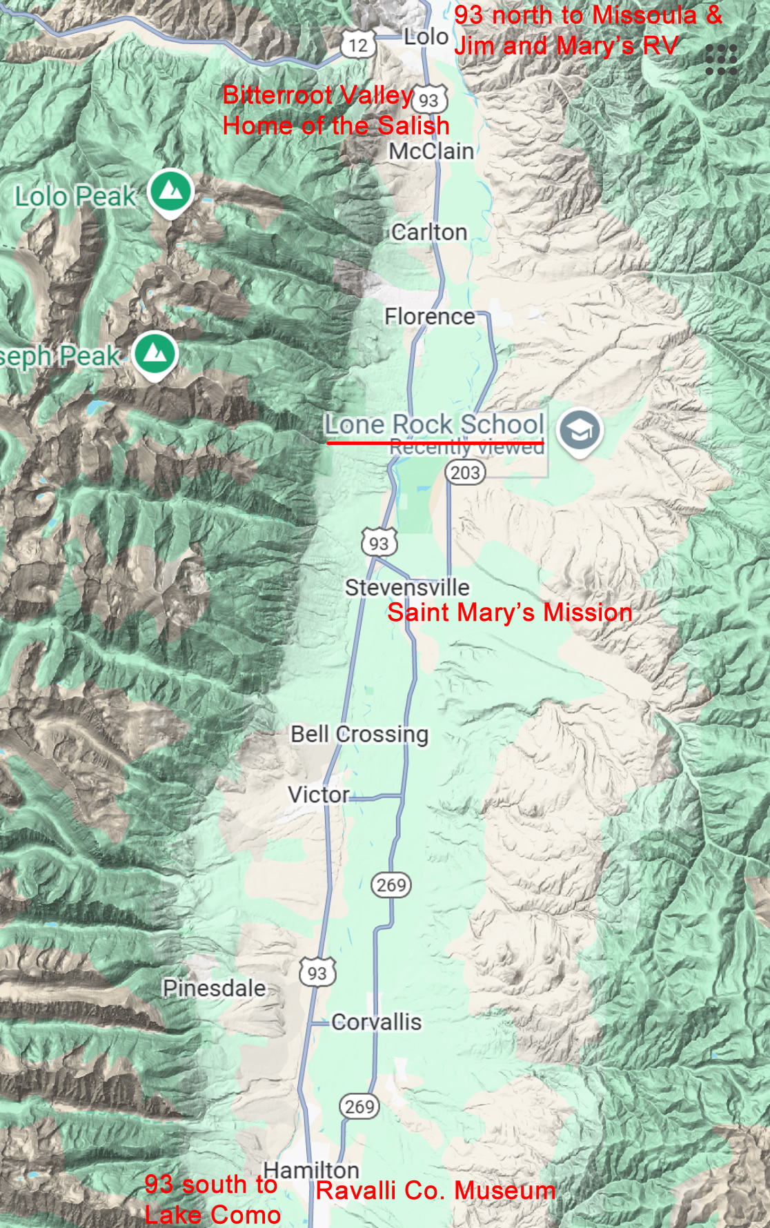
We decided to stay several more nights, but had to move our rigs the next day. After that we did a short loop along the Bitterroot River which was always just east of SR93. We stopped at the Ravalli County Museum & Historical Society in Hamilton, mostly about local events and Lewis & Clark’s expedition. There was also a display for Sue – the T-Rex, the most complete T-Rex fossil ever found, fascinating story: view here. Then we drove to Lake Como (but didn’t go around the lake due to fees) and Saint Mary’s Mission, then on to the Lone Rock School (named after an erratic in front, dropped by the Ice Age Floods). Our last stop was to read some signs about the history of the Bitterroot Valley with Lewis and Clark and the long time Home of the Salish people.
Be sure to see the main page for this set of travelogues so you can learn more about the Ice Age Floods. Go to: 2025 Ice Age Floods.
The video shows the flags flying across the river on Memorial Day next to the Riverside Cemetery, run by the city of Orofino.
The map shows our route along the Bitterroot River which meanders north just east of Rt. 93, until it merges with the Clark Fork River just west of Missoula. You can see from the terrain on the map that it’s in a large flat valley. Missoula is north of this, not shown.
Click to here to enlarge the map.


")


